1-800-833-7958 | Sales@geotechenv.com | Find a Location | Español | 中文 |

Geotech's Unmanned Aircraft Systems

The Technology

Geotech's Unmanned Aircraft Systems innovates, manufactures and distributes patented, unmanned technology which can be piloted remotely using advanced ground station products. Geotech's unmanned aerial systems (UASs) are certified for airworthiness, manufactured in the USA, and include pilot training.

Made in the USA

Geotech's lean manufacturing facility is ISO Certified and meets OSHA safety requirements. UAS technologies are now available for commercial, public and private applications. On-site maintenance and repair ensure your equipment is operating at peak performance and ready for your next assignment. With decades of aerospace experience, Geotech leads the industry in sensing technologies that are cutting-edge and adept at efficient solutions.


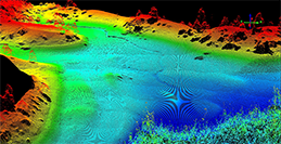
Geotech Drone Mapping Services 3D Sparse Point Cloud

Since 2009, Geotech has been utilizing sUAS (small-unmanned aircraft system) technology to collect videography, photography, and remote sensor data as a professional service. The services we offer provide an aerial perspective tailored to your needs. Collectively, our team offers decades of manned and unmanned aviation experience.

Why Choose Geotech?

  • FAA Approved
  • Fully Insured
  • Flying Commercial-grade sUAS Technology
  • Industry Specific Remote Sensors
  • Experienced Manned & Unmanned Pilots

Call 1.800.833.7958


Wind & Weather Sensors Anemoment TriSonica Mini

Li-Cor TriSonica™ Mini

The TriSonica™ Mini is a compact weather station that measures a suite of weather conditions with great accuracy. Using ultrasonic technology, the TriSonica™ Mini provides 3D wind direction, speed, air temperature, humidity, pressure, and compass data. The instrument uses four measurement path sensors for calculated redundancy and an open flow design providing the least possible distortion of the wind field.

  • Compact and lightweight
  • No maintenance, rugged design
  • Mount to unmanned aircraft systems for remote weather reporting
  • Real-time 3-dimensional air flow data
  • User customizable data outputs
  • Power optimization 9-36 VDC

Call 1.800.833.7958


Li-Cor TriSonica Mini Specifications
Li-Cor TriSonica Mini User Manual
Li-Cor TriSonica User App


Army, Made in USA, ISO

RDASS Quadcopter with strobe and GoPro camera

Remo-M Fixed-Wing UAS Remo-M Fixed-Wing UAS

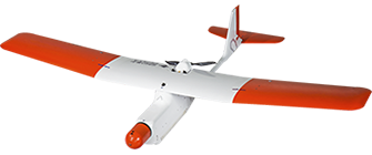
The Remo-M is widely used unmanned aircraft system built for mobility, rapid deployment, and aerial mapping applications. Featuring a one-of-a-kind deep-stall vertical landing feature, the Remo-M only requires a 15 meter radius landing area. Users benefit from the simplicity of flight planning software and intuitive user interface. Oblique images with roll axis gimbal for intelligent 3D modeling. The Remo-M is the most advanced fixed-wing UAV in its class, delivering greater efficiency, flight mission flexibility and simplicity.

  • Lightweight – hand-launch design
  • Autonomous Operation & Autoland
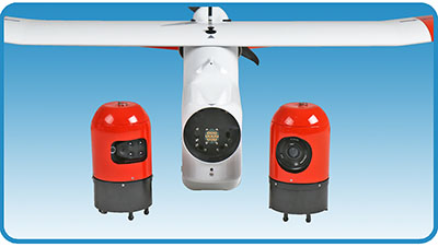
  • Quick interchangeable sensor payloads
    Sony 20mm, Rededge, Sequoia
  • Adjustable Angle (2-axis) Roll Gimbal
  • Flexible take-off and Landing

Call 1.800.833.7958