1-800-833-7958 | Sales@geotechenv.com | Find a Location | Español | 中文 |
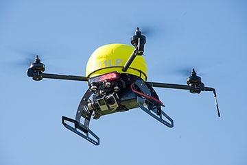
Leptron RDASS Precision
Unmanned Quadcopter
The Rapidly Deployed Aerial Surveillance System (RDASS) Precision by Leptron UAS, Inc. is a vertical takeoff and landing multirotor platform used for stability, versatility and professional-grade remote sensing. The RDASS Precision model offers the same aerodynamic aircraft design as the RDASS HD, but it integrates a military-grade autopilot system with precision GPS and an advanced inertial navigation system. The RDASS is commanded from Leptron's Precision Ground Control Station (PGCS) that supports autonomous flight operations with the option of taking direct control at any time. The PGCS also offers the pilot superior situational awareness by displaying aircraft position on a moving map and real-time video from the aircraft's camera(s).
The RDASS camera mounting system accepts Leptron stabilized or fixed gimbal configurations. Each gimbal is perfectly balanced to minimize power consumption to optimize in-air performance. Additionally, the RDASS Precision can be equipped with navigation LEDs, red and blue strobe lights, and additional video viewing stations. With dozens of user defined system configurations available, the RDASS Precision is an ideal choice for public agencies and sensitive sites.
- RDASS Model
Precision - Airframe Materials
Lightweight 3D Printed ABS and Carbon Fiber - User Selectable Cameras
- Payloads
Fixed, Stabilized
Single or Dual Camera Combinations - Video
High Definition Output
HD Remote Video Streaming Compatible - Endurance
20 Minutes - Flight Modes
Manual and Fully Autonomous - Auto Landing and Motor Shut-off
- Intelligent Fault Detection
Auto Return Home due to either Lost Link or Low Battery - Dome Colors
Black, Red, or Yellow
| Platform Type Rotor Tip to Rotor Tip Dimensions Operating Temperature Take-off Weight Weight without Battery Hovering Accuracy (GPS Mode) Maximum Yaw Angular Velocity Maximum Tilt Angle Maximum Horizontal Flight Velocity Wind Limits Vertical Speed Limits Supported Flight Battery Operational Ceiling Maximum Payload Operational Range Maximum Power Consumption |
Multi-Rotor (four fixed-pitch rotors) 32 9/16 inches (82.7 cm) -10°C – 50°C 7 lbs. 13 oz. (3539 g) 5 lbs. (2269 g) Vertical: ±31 in. (0.8 m) Horizontal: ±98 in. (2.5 m) 180°/s 35° 35 mph (30 knots, 15 m/s) 35 mph (30 knots, 15 m/s) continuous or gusts of 25 mph (22 knots, 11 m/s) 800 feet/min. (4.1 m/s) LiPo 6S 12,000 feet DA (3650 m) 1 lb. 8 oz. (680 g) 1.5 mile (2.4 km) 800 Watts (1.1 hp) |
|
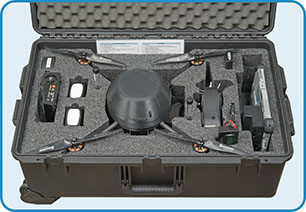 Leptron RDASS Precision Kit |
|
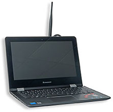
Precision Ground Control Station (PGCS)
|
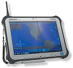 Precision Ground Control Station 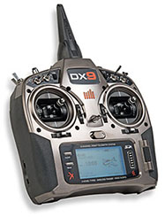 RDASS Precision Controller |
|
 Additional View 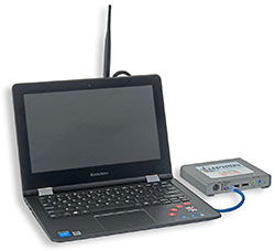 Additional View Ethernet Out 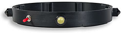 Navigation Lighting 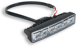 Emergency Lighting |
| GoPro with Stabilized Gimbal – Eliminates tilt and vibration • Available with GoPro Hero4 Black, Hero5 Black, and Hero6 Black FLIR Duo Pro R with Stabilized Gimbal (not shown) – Combines high resolution, radiometric thermal imager, 4K color camera, and a full suite of on-board sensors for a powerful dual-sensor imaging solution • Available with FLIR Duo Pro R 336 x 256 or 640 x 512 30hz cameras Stabilized Gimbal with GoPro and FLIR Vue Pro – Incorporates a GoPro and FLIR VUE series thermal/IR camera with three-axis tuning • Available with FLIR Vue, FLIR Vue Pro, or FLIR Vue Pro R Sony Camera Gimbal – Designed for the Sony Alpha a6000 camera to provide a versatile and advanced aerial mapping and data collection camera • Available with RTK/PPK MicaSense RedEdge Camera with Gimbal – Multispectral camera for accurate multi-band data and agricultural remote sensing |
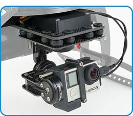 Stabilized Gimbal with GoPro Hero4 Black 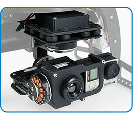 GoPro and FLIR Vue Pro with Stabilized Gimbal 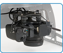 Sony Alpha a6000 with Gimbal 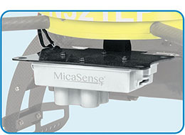 MicaSense RedEdge Camera with Gimbal |

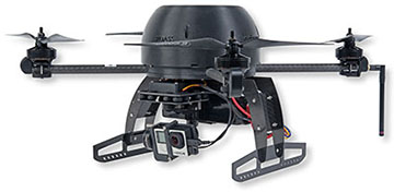
| Leptron RDASS Precision with optional Stabilized Single-Camera setup using a GoPro Hero4 camera |
Geotech Environmental Equipment, Inc.
2650 East 40th Avenue
Denver, CO 80205

A Geotech Company
Shop our Products Online
© 2025 Geotech Environmental Equipment, Inc. All rights reserved.

| About | Customer Service | Events | Stay Connected | |||
|---|---|---|---|---|---|---|
| Geotech Manuals | Contact Us | Annual Field Days | ||||
| Vendor Manuals | Locations | Tradeshows | Newsletter Sign-Up | |||
| Company History | Warranty & Returns | Photo Competition | ||||
| Mission, Vision & Values | Credit & Terms | |||||
| Community | ||||||
| Press Releases | ||||||
| Careers |